
The Best Offense is an Observant Defense: Aquatic Invasive Species
In lieu of the exciting results of the Exotic Aquatic Species Watch completed for the Cooperative Lake Monitoring Program in 2018, it is imperative to keep Gratiot Lake free of aquatic invasive species. The watch found no aquatic invasive plant species in Gratiot Lake! The best way to take on aquatic invasive species is to prevent them from colonizing in the first place.
The Michigan Department of Natural Resources (MiDNR) recently amended the Natural Resources and Environmental Protection Act (Act 451 of 1994) Part 413 with changes for boaters and anglers that take effect March 21, 2019. The changes are intended to better protect waterways from the introduction and spread of aquatic invasive species.
For more information, click the link below:
https://www.michigan.gov/invasives/0,5664,7-324-68071_91899---,00.html?utm_source=govdelivery
Key Changes for Boaters:
All of the following must be completed prior to transporting watercrafts over land:
Removing all drain plugs from bilges, ballast tanks, and live wells.
Draining all water from any live wells and bilges.
Ensuring the watercraft, trailer, and any conveyance used to transport the watercraft or trailer are free of aquatic organisms, including plants.
Key Changes for Anglers:
A person shall not release baitfish in any waters of this state. A person who collects fish shall not sue the fish as bait or cut bait except in the inland lake, stream, or Great Lake where the fish was caught, or in a connecting waterway to the body of water if the fish could freely move between the original location of capture the location of release.
A person, who catches fish other than baitfish in a lake, stream, Great Lake, or connecting waterway shall only release the fish in the lake, stream, or Great Lake where the fish was caught, or in a connecting waterway of the body of water where the fish was caught if the fish could freely move between the original location of capture and the location of release.
Below is a diagram (from the MiDNR) for how to correctly inspect and drain your watercraft:

2018 Cooperative Lakes Monitoring Program

2018 Cooperative Lakes Monitoring Program Report for Gratiot Lake
Read more2017 Cooperative Lakes Monitoring Program Report
Gratiot Lake Conservancy (GLC), in conjunction with some lake locals, collects data points annually to contribute to the Cooperative Lakes Monitoring Program (MiCorps). GLC has been providing data since 1999 to the program and is excited to continue to in the future.
MiCorps is a network of volunteer water quality monitoring programs in Michigan. It was created through Michigan Executive Order #2003-15 to assist the Department of Environmental Quality (DEQ) in collecting and sharing water quality data for use in water resources management and protection programs. To learn more about them click here: About MiCorps .
The 2017 report indicates Gratiot Lake is a 36 on the Trophic Scale Index, a metric used to evaluate the productivity, quality, and condition of a lake. The 36 places Gratiot Lake between an Oligatrophic Lake (think a barren, not very productive lake) and a Mesotrphic lake (medium amount of aquatic life and relatively productive). Given the size of Gratiot Lake, this ranking makes sense and is a good indicator of a healthy lake.
It is important to continue these measurements in order to monitor the condition and quality of the lake. If Gratiot Lake starts moving to a higher or lower number (scale is 0-100), it could indicate a potential problem or threat to the lake’s ecosystem and food web.
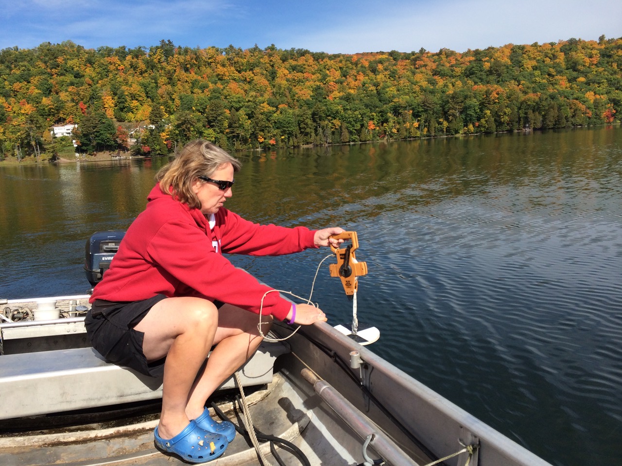
Dorothy Jamison taking Secchi Reading at Gratiot Lake in 2014
Water's Edge Fall 2018 Edition

Welcome Ian Lizzadro-McPherson

The GLC Board is pleased to announce that Ian Lizzadro-McPherson is moving into the role of Program Director of GLC. Ian has deep roots in the U.P. His great grandparents immigrated to find a better life in the Keweenaw in the early 1900’s. While Ian grew up in Illinois, Arizona, New Mexico, and Wisconsin, he spent most childhood summers at Gratiot Lake where he forged a deep connection to Gratiot Lake and GLC. Ian recently relocated to the area.
Ian has a BA in Biology and Chemistry with a focus in limnology from Lawrence University. He also has a solid resume in the environmental field. He is enthusiastic about the importance of conservation and good environmental stewardship and is a strong advocate for conservation and sustainability. Ian hopes to spark that same passion in his own children and future generations. He looks forward to his role in GLC.
His motto: “Lead by example, learn through experience, and live with nature.”
Lizzadro Farms Donates "Sandy Beach" Land (2018)

GLC is pleased to announce the recent addition of a 184.46 acre parcel to the Gratiot Lake Preserve. This parcel is the most recent gift of land from Lizzadro Farms, Inc. Much of its 3,000 foot stretch of shoreline is known by residents at Gratiot as “Sandy Beach.” The lakeshore is a mix of sand and of cobble stretches. Inland is a mixed hardwood/conifer forest and wetlands. The Little Gratiot River snakes its way through a portion of it. The land is an especially significant conservation addition because it is contiguous with the Little Gratiot River Wilderness which forms a nearly intact wildlife corridor to the Bete Grise Preserve and to Lake Superior. It abuts the portion of the Gratiot Lake Preserve which includes the Noblet Field Station.
In 2014, we announced the donation to GLC of 18.75 acres with approximately 2075 feet of shoreline on the west end of Gratiot Lake. The land was donated by Lizzadro Farms in December of 2013. This conservation area includes some upland forest but consists mainly of cedar swamp and other wetlands. It can be accessed by canoe, kayak, or other small watercraft for low impact activities such as hiking and birding. Wildlife observed in recent years on this lakeshore include river otter, beaver, bobcat, black bear, deer, bald eagles, loons, kingfishers, ducks, and great blue heron. A botanical survey of this nature sanctuary began in May of 2014.
Geo Tour at Gratiot Lake

Two pontoon sessions were needed to accomodate the number of participants for GLC board member and geologist Daniel Lizzadro-McPherson’s geo-tour at Gratiot Lake.
From the pontoon boat and at the GLC Preserve participants viewed the amazing topography of Gratiot Lake, a 10,000-year-old glacially formed plunge pool carved out of 960-million-year-old Jacobsville sandstone. The lake’s mountain-backed northeastern shoreline marks an important geologic boundary, the Keweenaw Fault. One-billion-year-old lava flows (known as the Portage Lake Volcanics) sitting high above the Gratiot Lake have been thrust up and over the younger Jacobsville sandstone. The Keweenaw Fault is inferred from the sharp change in topography and bedrock.
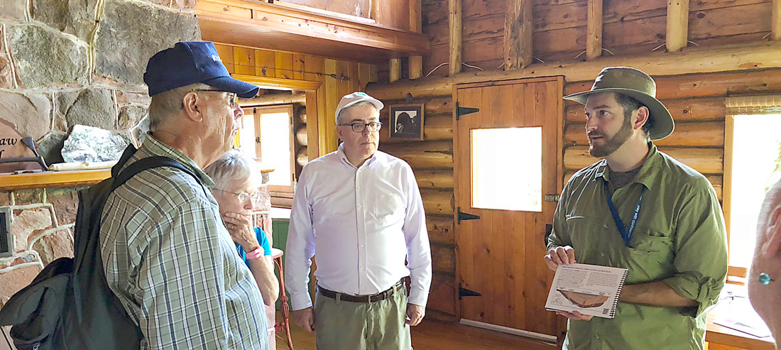
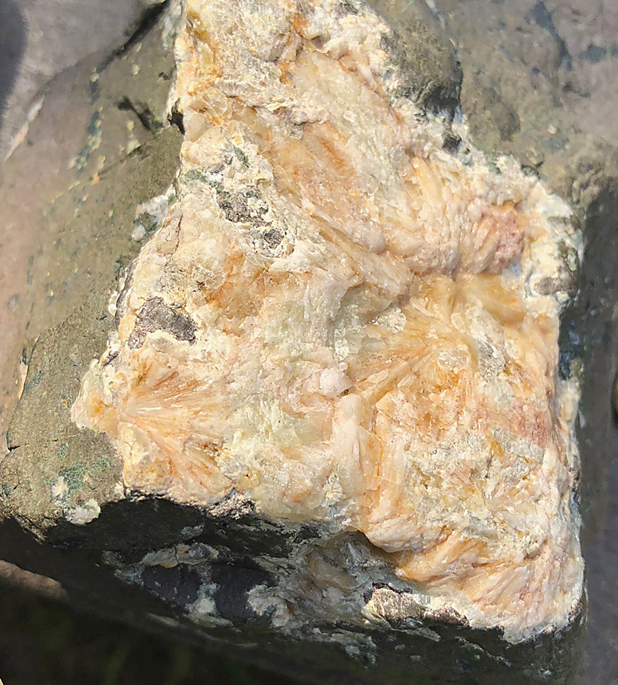
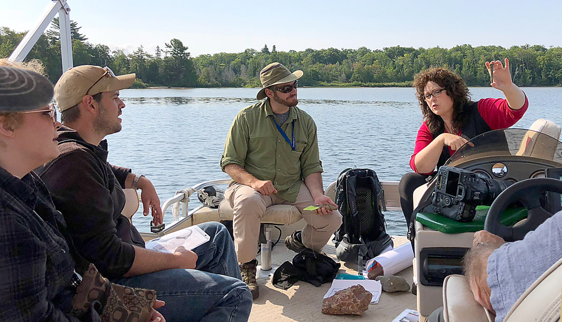
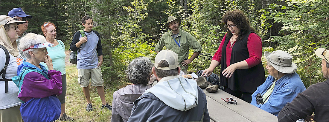

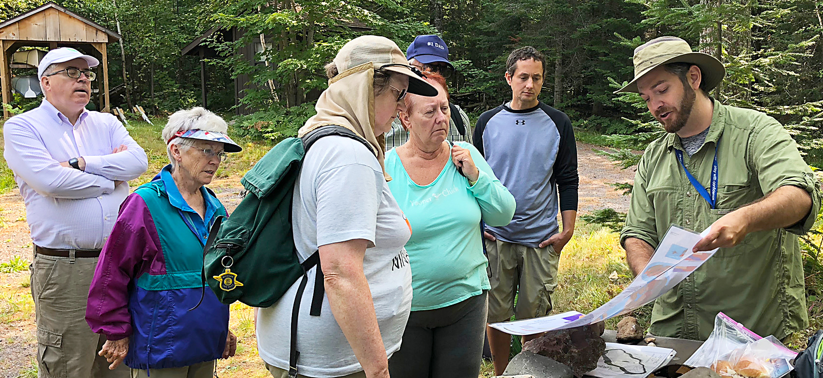

From the boat, Daniel was able point out the evidence of powerful forces that formed what on that summer day seemed a placid landscape. The group also visited the Gratiot Lake Conservancy land to identify shoreline pebbles and boulders and to picnic at the Noblet Field Station.
Daniel is in the process of mapping this specific segment of the fault as part of his Master’s thesis at Michigan Tech. He has done work on Keweenaw GeoHeritage, fieldwork on the Keweenaw fault to enhance the USGS EdMAP, and is a GIS analyst at Michigan Tech’s Great Lakes Research Center.
Part of the tour was put on YouTube by participant Robin Mueller and can be viewed at
https://youtu.be/adNNmZ1V3Bs
Below are related sources

Geologist Bill Rose’s Geoheritage website page about Gratiot Lake:
http://www.geo.mtu.edu/KeweenawGeoheritage/The_Fault/Gratiot_Lake.html

How the Rocks Connect Us: A Geoheritage Guide to Michigan’s Keweenaw Peninsula and Isle Royale,
by Bill Rose and Ericka Vye with Valerie Martin.
This handbook is a comprehensive overview of underlying geologic features and their influence on human life and the history of the region. It has lots of photos and maps that clearly illustrate information presented. The text is concise and understandable so a geology degree is not required to understand it. Handy links to further information on the geoheritage website are with each topic and location highlighted. This book is available at some local stores, at the Keweenaw National Historical Park Visitor Center in Calumet, or from the Isle Royale & Keweenaw Parks Association at https://irkpa.org/.